Kankawathi Fm
Type Locality and Naming
OUTCROP. Named after Kankawathi River. [Original Publication: Raju, D.S.N. and Misra, R. (2009) Proterozoic and Phanerozoic integrated stratigraphy (South-East Asia). ONGC Bulletin, Special publication, vol. 44 (2),pp.]
Synonyms: Upper Siltstone Member of the Vinjhan Shale of Biswas and Raju (1971, 1973) and Upper Siltstone Member of Chhasara Fm (Chassara Fm ) of Biswas (1992) (Source: Raju and Misra, 2009).
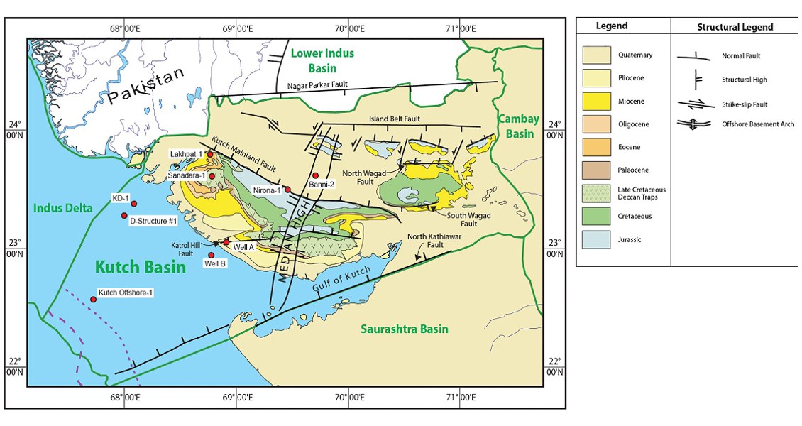
[Fig. Geological and structural map of Kutch, also showing the onshore and offshore wells drilled for oil exploration. (Map by Rasoul Sorkhabi in GeoExpro Dec2014, based on various sources including S.K. Biswas, Current Science, 25May2005)]
Lithology and Thickness
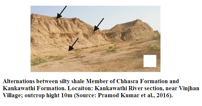
Siltstone. The Kankawathi Formation is characterized by alternations between silty shale and siltstone. The siltstone is micaceous, hard and parallel laminated. The Siltstone Member is characterized by the absence of trace fossils and rare occurrence of reworked Ammonia, ostracods and spines of echinoids (Source: Pramod Kumar et al., 2016).
[Figure 1: Alterations between silty shale Member of Chhasra Fm and Kankawathi Fm. (Source: Pramod Kumar et al., 2016)]
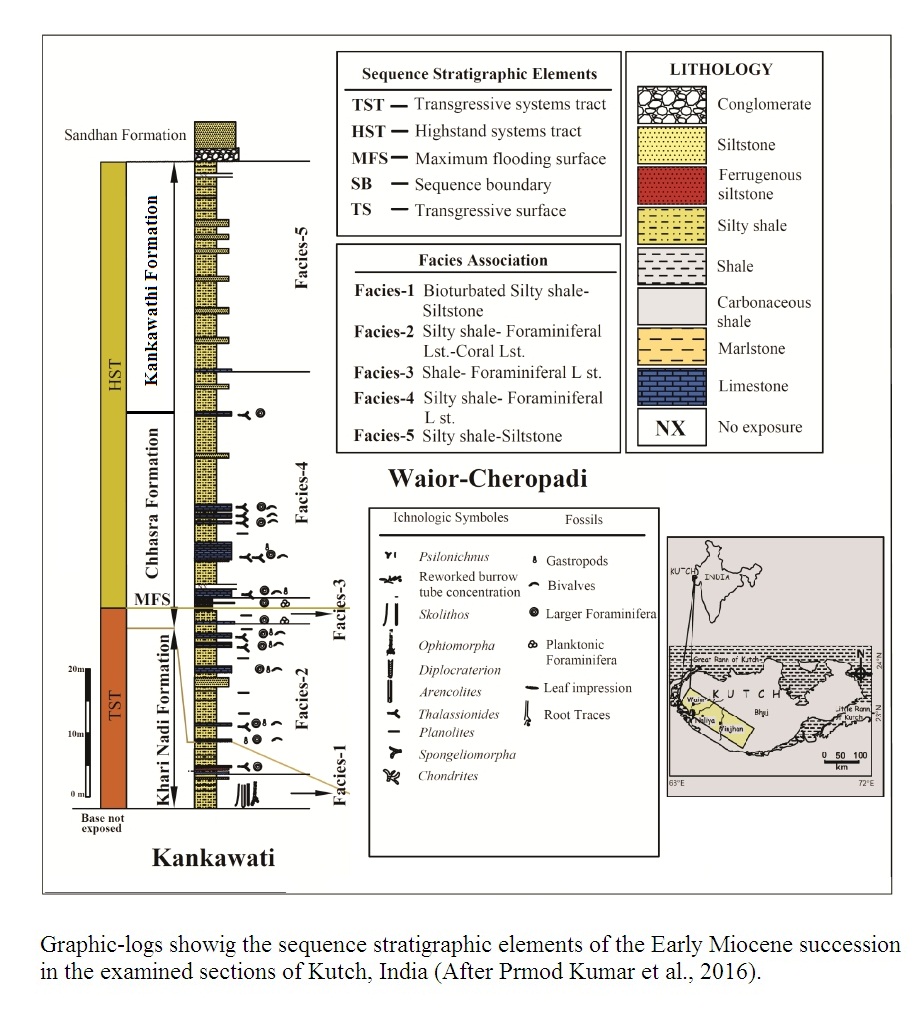
[Figure 2: Graphic Logs showing the sequence stratigraphic elements of the early Miocene succession in the examined section of Kutch. (after Pramod Kumar et al., 2016)]
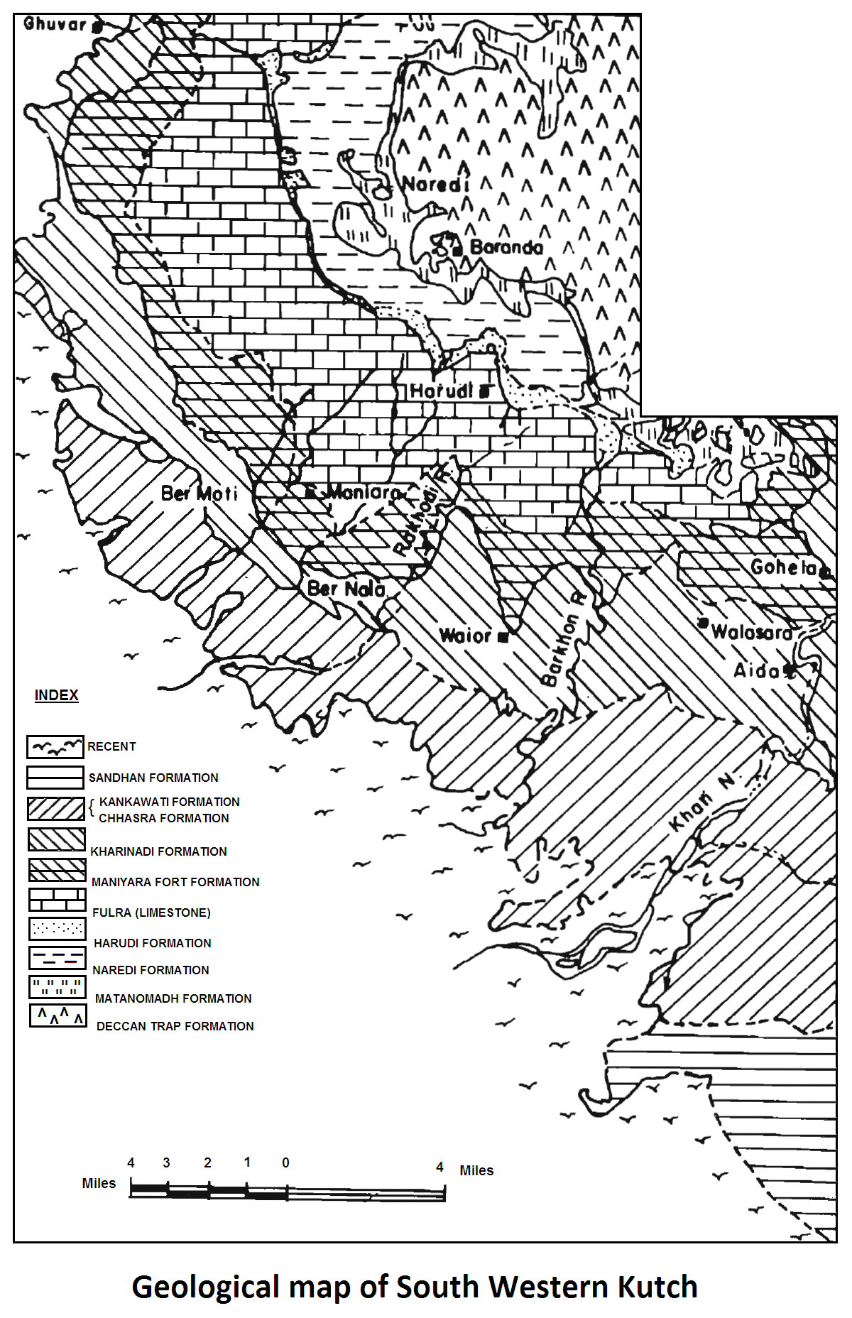
[Figure 3: Geological Map of South Western Kutch]
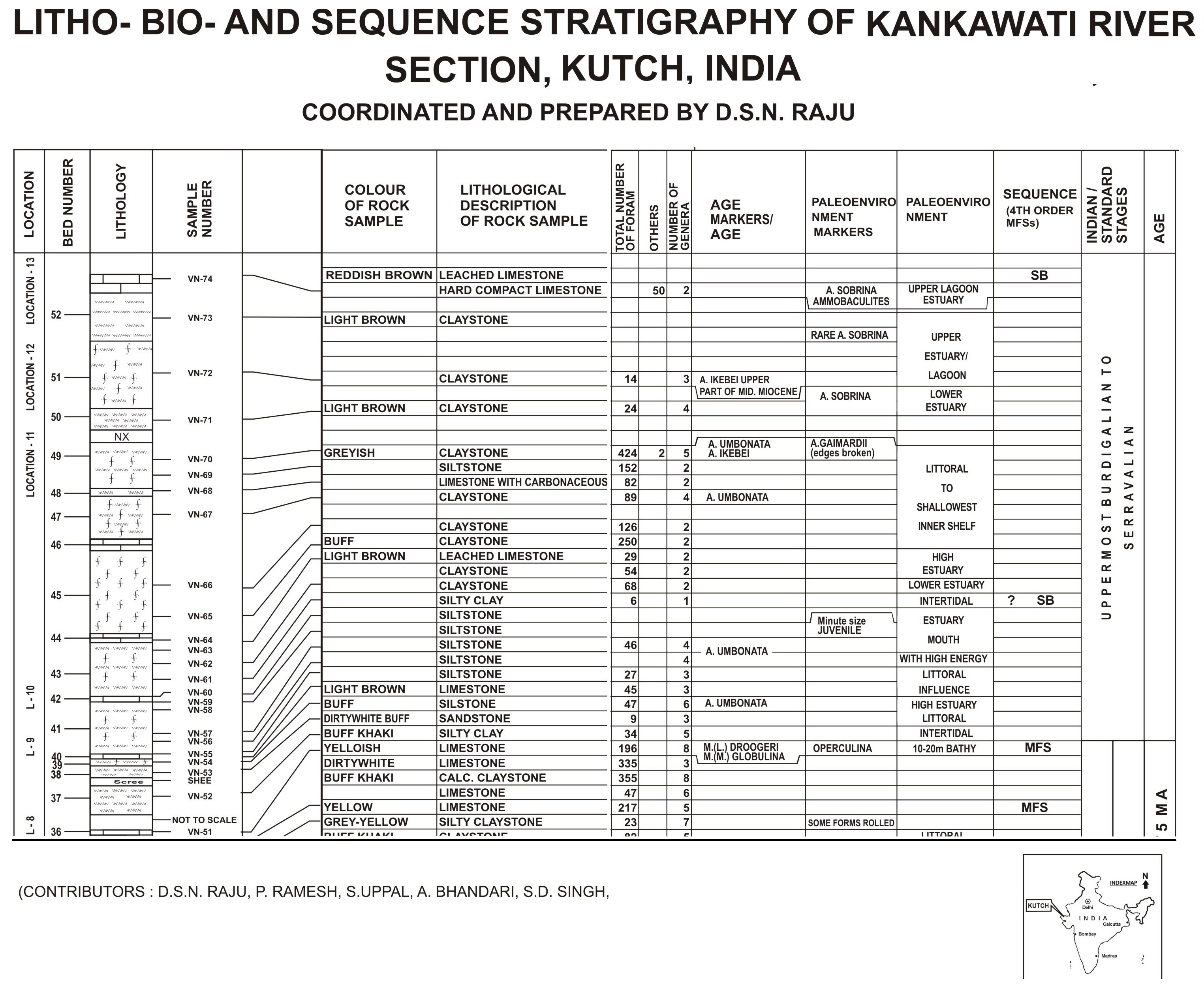
[Figure 4: Litho-Bio and Sequence Stratigraphy of Kankawati River Section, Kutch. (coordinated and prepared by D.S.N Raju)]
Relationships and Distribution
Lower contact
Lower boundary with the Chassara Fm is conformable.
Upper contact
Upper boundary with the Sandhan Fm is marked by a prominent disconformity.
Regional extent
It is exposed only along the bank of Kankawati River (Figure under outcrop photograph).
GeoJSON
Fossils
A few fossiliferous marl beds contain Ammonia ikebei and Ostracodes
Age
Depositional setting
The environment of deposition was lagoonal / estuarine / littoral with occasional incursions of open sea.
Additional Information
Sequence Stratigraphy - Third-order sequence (Middle Miocene): The uppermost third-order Middle Miocene sequence is studied at the Kankawati river section. It is represented by siltstone, shale, and thin limestone with smaller benthic foraminifera, indicating deposition in a shallow-water environment with a bathymetry of c. 35m.
The lower boundary with the third-order Early Miocene sequence is a disconformity (i.e., a wave-ravinement surface that reworks and replaces a subaerial unconformity). The upper boundary is not exposed in the section.
This sequence is missing in other areas of the basin, including the Khari Nadi section discussed below.
